
Blog > Big Island Climate Zones: How the World's Most Diverse Island Shapes Where You Live
Big Island Climate Zones: How the World's Most Diverse Island Shapes Where You Live
by
Big Island Climate Zones: How the World's Most Diverse Island Shapes Where You Live
A luxury real estate guide to the microclimates, landscapes, and lifestyle decisions that define Big Island living.
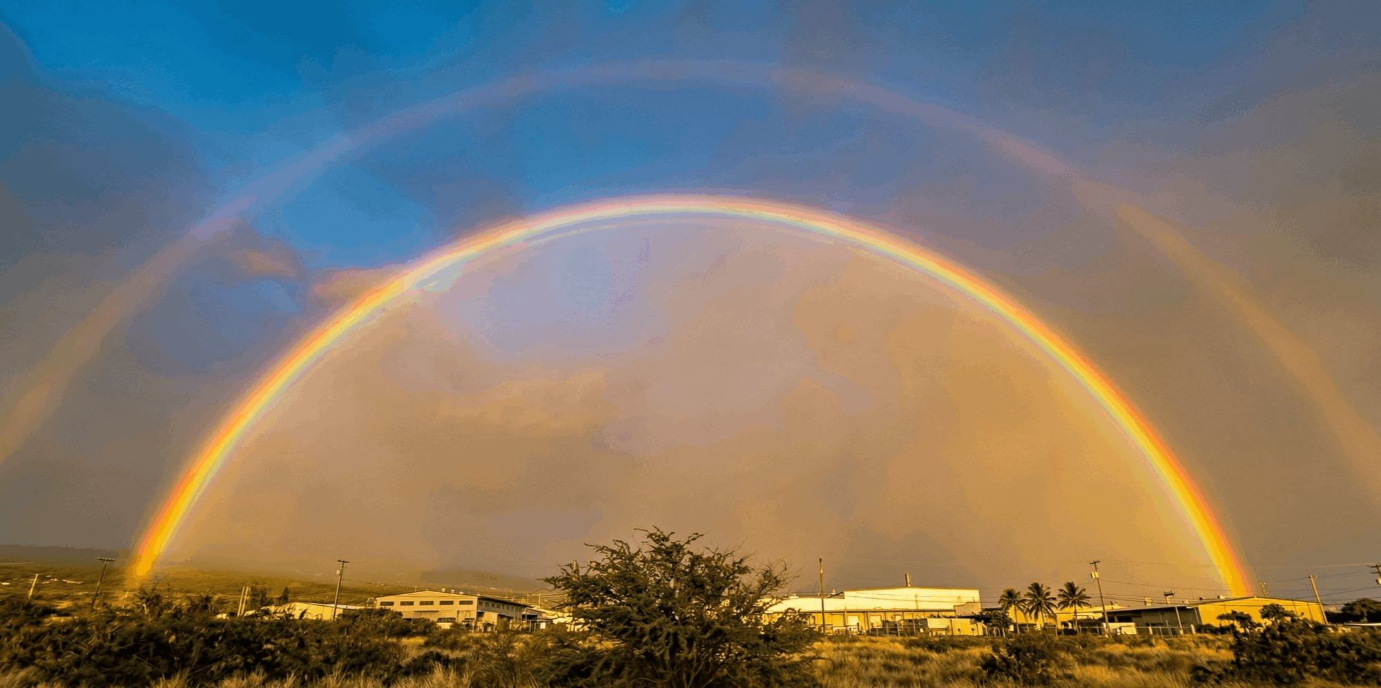
The Big Island of Hawaii — one island, a world of climates.
The Big Island of Hawaii is the only place on earth where you can drive through nearly all of the world's major climate zones in a single afternoon. From the sun-drenched lava coasts of Kona to the misty rainforests of Hilo, from cool upcountry pastures in Waimea to the volcanic highlands near Kīlauea, this island compresses a planet's worth of weather into 4,028 square miles. For luxury buyers considering Big Island real estate, this is not a piece of trivia. It is the single most important factor shaping your lifestyle, your property's long-term value, and your daily experience of home.
Understanding Big Island climate zones is a sophisticated buyer's advantage — and one that separates informed decisions from costly surprises. In this guide, I walk you through every major climate region on the island, what each means for real estate, and how to match the right zone to the life you want to live in Hawaii.
Why the Big Island Has More Climate Zones Than Most Countries
The world's climates are classified using the Köppen system, which divides the earth into five major groups and thirteen sub-zones. The Big Island of Hawaii contains eight to ten of those sub-zones, depending on the classification granularity used — a concentration of climate diversity unmatched by islands many times its size, and rivaling entire continents.
The science behind this is straightforward but remarkable. Two massive shield volcanoes — Mauna Kea (13,796 ft) and Mauna Loa (13,681 ft) — rise from the ocean floor and split the prevailing northeast trade winds. Moisture-laden air hits the windward slopes, rises, cools, and releases rain. By the time it crosses the summits, the air is dry. This rain shadow effect creates the dramatic divide between the lush, wet windward side and the arid leeward coast.
Add in the trade-wind inversion layer — a ceiling of warm air that traps clouds at roughly 6,000 feet — and the localized Kona rainfall belt on the western slopes, and you have an island where annual rainfall varies from 10 inches to over 200 inches within a 30-mile drive. For real estate, this means Hawaii Big Island microclimates make every neighborhood its own distinct proposition. Where to live on the Big Island depends, more than anywhere else, on climate.
Leeward Coast — The Sunlit Side
Sunset on the Kohala Coast — the heart of Big Island luxury resort living.
The leeward coast — spanning Kailua-Kona, the Kohala Coast, and Waikoloa — is the Big Island's premier luxury corridor. Sheltered from trade winds by the volcanic massifs, this coast receives roughly 18 inches of annual rainfall and enjoys 275 or more sunny days per year. Daytime temperatures hold comfortably in the mid-70s to mid-80s year-round.
This is where you will find the island's highest-concentration resort communities: Mauna Lani, Mauna Kea Resort, Hualālai, and Waikoloa Beach Resort. The lifestyle centers on oceanfront living, world-class golf, water sports, and proximity to fine dining along the resort corridor. [LINK: Kona Coast Neighborhood Guide]
Real estate insight: The leeward coast commands the island's highest price per square foot. Resort-branded residences at Hualālai and Mauna Lani consistently lead in both transaction volume and appreciation. Inventory is constrained by zoning and geography, which supports long-term value. For buyers seeking a sun-guaranteed lifestyle with strong resale fundamentals, this coast is the benchmark. [LINK: Big Island Luxury Listings]
Kona vs. Hilo climate: The Kohala Coast receives as little as 10 inches of rain annually, while Hilo — just 85 miles away — receives over 130 inches. Same island, entirely different worlds.
Kona Coffee Belt — Where Cloud Forest Meets Cultivation
The Kona Coffee Belt — elevated estates with panoramic ocean views and artisan agricultural heritage.
Climb just a few miles upslope from Kailua-Kona and the climate shifts noticeably. The Kona Coffee Belt — encompassing Holualoa, Captain Cook, and Kealakekua — sits between 1,500 and 2,500 feet in elevation. Here, mornings dawn clear and sunny, afternoon clouds roll in to provide natural shade, and temperatures run cooler than the coast by five to ten degrees. Annual rainfall is moderate, typically 40 to 80 inches, perfectly calibrated for coffee cultivation.
The lifestyle here is quieter, more artisan. Holualoa's gallery scene, organic farms, and world-renowned coffee estates define a pace that appeals to buyers seeking privacy and authenticity. The panoramic ocean views from this elevation — looking down across miles of coastline — are among the finest on the island.
Real estate insight: Properties in the Coffee Belt often combine residential living with productive agricultural land. A working coffee farm can generate revenue while offering substantial acreage, privacy, and tax advantages through agricultural zoning. Land value here is increasingly tied to the global reputation of Kona coffee, and estates with established orchards command a meaningful premium. For buyers who want both a Hawaii address and productive land, this zone is difficult to match. [LINK: Big Island Buyer's Guide]
Waimea and Upcountry — Cool Mornings, Open Pastures
Waimea's Parker Ranch country — where Hawaii meets wide-open ranch living.
Waimea (Kamuela) sits at 2,600 to 2,800 feet on the saddle between the Kohala Mountains and Mauna Kea. The climate is temperate by Hawaii standards: morning temperatures in the mid-50s, afternoon highs in the low to mid-70s, with distinct day-night swings that feel more like Northern California wine country than the tropics. Rainfall is moderate, and the air carries a crispness that surprises first-time visitors.
This is ranch country. The heritage of Parker Ranch — one of the largest cattle ranches in the United States — defines the culture. Farm-to-table dining anchored by Merriman's, equestrian pursuits, and a tight-knit community of families and professionals give Waimea a distinct identity on the island. Big Island weather by area varies dramatically, and Waimea offers something no coastal town can: a cooler, four-season feel without leaving Hawaii. [LINK: Waimea Living Guide]
Real estate insight: Waimea commands a cooler-climate premium. Gentlemen's ranches, equestrian properties, and homes on multi-acre parcels attract mainland buyers who want a Hawaii address without persistent tropical heat. The town also benefits from strong local infrastructure — quality schools, medical facilities, and proximity to the Kohala Coast resorts, just 20 minutes downhill. Appreciation has been steady, driven by limited inventory and consistent demand from a discerning buyer profile.
Windward Side — Lush, Green, and Alive
Akaka Falls on the Hāmākua Coast — the windward side's iconic cascading beauty.
Hilo, the Hāmākua Coast, and Puna form the Big Island's windward corridor — the side that catches the full force of the trade winds and their moisture. Hilo receives over 130 inches of annual rainfall, making it the wettest city in the United States. The result is a landscape of extraordinary lushness: waterfalls, botanical gardens, old-growth rainforest, and vegetation so dense it borders on the primordial.
The lifestyle here is nature-first. Farmer's markets, a thriving artistic community, rainforest hikes, and the Hāmākua Heritage Corridor define daily life. Hilo retains an authenticity that the resort side of the island left behind decades ago — and that authenticity is increasingly valued by a certain type of buyer.
Real estate insight: The windward side offers the Big Island's most compelling value proposition. Price points are significantly lower than the leeward coast, and available acreage is substantially larger. A budget that buys a condominium in Waikoloa can secure a multi-acre estate with ocean views near Hilo. However, buyers must plan for moisture management — proper ventilation, durable finishes, mold-resistant construction, and regular maintenance are non-negotiable in this climate. The investment opportunity is real, particularly in Hilo town, where revitalization efforts and growing remote-work migration are fueling steady appreciation. [LINK: Big Island Buyer's Guide]
Volcanic Highlands and Ka'ū — The Untouched Frontier
Hawaiʻi Volcanoes National Park — the dramatic backdrop to life in the volcanic highlands.
Volcano Village sits at roughly 4,000 feet on the edge of Hawaiʻi Volcanoes National Park. The climate is cool and misty — average temperatures in the 60s, frequent fog, and a lush native ōhiʻa forest canopy. Further south, Ka'ū stretches toward South Point (Ka Lae), the southernmost point in the United States, where conditions shift drier and windier. Nā'ālehu and Ocean View offer a rugged, open landscape unlike anywhere else on the island.
Real estate insight: This is the Big Island's most affordable entry point. Larger parcels — often five to twenty acres — are available at price points that would be unthinkable on the leeward coast. Volcano Village appeals to buyers seeking solitude, creative retreat space, and proximity to one of the world's most active volcanic landscapes. Ka'ū attracts those with a frontier mentality and an interest in off-grid living. An honest note: infrastructure in parts of Ka'ū, particularly Ocean View, remains limited. Road access, water catchment, and utility availability require due diligence. For the right buyer, the reward matches the remoteness.
How Climate Zones Affect Property Value on the Big Island
On the Big Island, climate is not just atmosphere — it is economics. The correlation between sun exposure and price per square foot is direct and well-documented. Leeward properties with consistent sunshine and low humidity command premiums that reflect both lifestyle desirability and lower long-term maintenance costs.
Maintenance costs vary dramatically by zone. Windward homes face higher expenses related to moisture intrusion, mold remediation, and exterior wear. Leeward properties contend with UV degradation, salt air corrosion, and irrigation needs. Upcountry homes in Waimea and Volcano require attention to temperature fluctuations and occasional frost at higher elevations.
Insurance is another climate-driven variable. Lava hazard zone designations directly affect coverage availability and cost. Flood zone mapping, coastal erosion risk, and hurricane exposure all factor into underwriting decisions that vary by microclimate. Understanding these layers before you make an offer is essential.
Resale patterns reinforce the climate-value connection. Leeward properties historically hold value through market cycles. Windward and Ka'ū properties, while offering lower entry points, present stronger growth potential as infrastructure improves and buyer demographics shift. Climate zone awareness is, ultimately, a financial advantage. [LINK: Climate Zone Interactive Map]
Choosing Your Climate — A Buyer's Framework
Every buyer arrives on the Big Island with a different vision. The question is not which climate zone is best — it is which zone is best for you. Use this framework to align your priorities with the right region of the island.
| What Matters Most to You | Your Climate Zone | Start Here |
|---|---|---|
| Sun, beach, and resort lifestyle | Leeward Coast | Kohala Coast, Kailua-Kona |
| Privacy, land, and agricultural character | Kona Coffee Belt | Holualoa, Captain Cook |
| Cool climate, space, and community | Waimea Upcountry | Waimea (Kamuela) |
| Nature immersion and value | Windward Side | Hilo, Hāmākua Coast |
| Solitude, adventure, and frontier spirit | Ka'ū / Volcanic Highlands | Volcano Village, Nā'ālehu |
The right climate zone shapes everything — from the way your morning coffee tastes to the way your investment performs over a decade. It is worth getting right.
Frequently Asked Questions About Big Island Climate Zones
How many climate zones does the Big Island of Hawaii have?
The Big Island contains eight to ten of the world's Köppen climate sub-zones, depending on the classification granularity used — spanning four of the five major climate groups (tropical, arid, temperate, and polar). This makes it one of the most climatically diverse landmasses on earth, rivaling areas hundreds of times its size.
What is the driest area on the Big Island?
The Kohala Coast, located on the northwest leeward shore, is the driest area on the Big Island, receiving as little as 10 inches of annual rainfall. This is where the majority of the island's luxury resorts and sun-oriented residential communities are located.
What is the best climate zone for luxury real estate on the Big Island?
The leeward coast — particularly the Kohala Coast corridor including Mauna Lani, Hualālai, and Mauna Kea Resort — is the established center of Big Island luxury real estate. Consistent sunshine, low humidity, and resort-level amenities drive the highest price points and strongest appreciation. However, Waimea and the Kona Coffee Belt attract a growing segment of luxury buyers seeking cooler climates and larger estates.
Does the Big Island climate affect home maintenance costs?
Yes, significantly. Windward homes in high-rainfall areas like Hilo require ongoing investment in moisture management, mold prevention, and durable exterior finishes. Leeward homes face UV degradation and salt-air corrosion. Upcountry properties in Waimea and Volcano must address temperature swings and occasional frost. Matching your construction approach to your climate zone is essential to protecting your investment.
What is the temperature range across Big Island climate zones?
Coastal areas on both the leeward and windward sides average 72°F to 85°F year-round. Waimea, at 2,670 feet, averages 55°F to 75°F. Volcano Village, at 4,000 feet, averages 55°F to 65°F. The summit of Mauna Kea can drop below freezing, with occasional snow — all on the same island.
How does elevation affect climate on the Big Island?
Elevation is the primary driver of temperature variation on the Big Island. Temperatures decrease approximately 3.5°F for every 1,000 feet of elevation gain. This is why coastal Kona sits in the mid-80s while Waimea, just 20 minutes uphill, can feel like a spring morning in Northern California. The trade-wind inversion layer, typically around 6,000 feet, also traps clouds below that altitude, creating distinct wet and dry bands on the mountain slopes.
Your climate zone shapes your lifestyle. Let's find the one that fits.
Jennifer Bien, REALTOR®
RB-24077 | CRS, Luxury Marketing Specialist
NextHome Luxury | Big Island, Hawaii

Brought to you by Jennifer Bien, RB 24077
Search Hawaii Island Real Estate
Contact Me: 808-938-3052 or jenniferlbien@gmail.com